Evacuation Maps

Evacuation Maps Sydney

In an emergency, all occupants of a building must know how to get to safety. Evacuation maps are a vital resource to help people leave safely. Staff, visitors, and building occupants are more likely to find all of the exits and safety equipment if they have an easy-to-understand visual aid. 

Evacuation maps need to be customised to the specific layout of the building and all of its surrounding areas. Our professionals can prepare site-specific evacuation maps for offices, schools, and health care facilities across Sydney and select other locations in New South Wales. Our maps are compliant with the AS 3745-2010 and WHS standards and highly readable. 

Why Evacuation Maps Matter?

Emergency plans can be hard to understand. That all changes with evacuation maps. People don’t have a lot of time to think in a stressful situation like a fire. Having a map makes things simple and focuses people’s decisions to get to the right place. This helps ensure assembly points are reached. Maps help with firevacuation plans and diagrams to ensure safety in your building. 

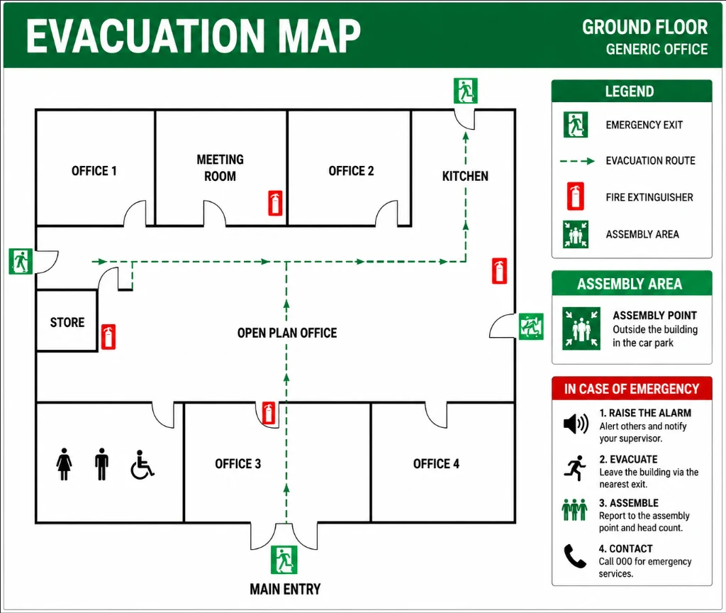
Generic Office Map

The image shows a sample office floor layout. This includes corridors, exits, assembly areas, and fire safety equipment.

What Does This Map Show?

  • Signs showing the locations of emergency exits to lead staff and guests out of the building.
  • Signs showing the best routes for everyone to use to get to the assembly area.
  • Signs showing the locations of fire extinguishers in the building.
  • Signs designating the assembly area where everyone goes after exiting the building.

Keeping extra information off this map presents all of the above information clearly and concisely to staff and guests in a time-sensitive emergency.

How We Create Office Maps?

  1. Site Assessment: Analyse the floor plans and building layout.
  2. Mapping: Create maps that clearly and visually illustrate the exits, equipment, and assembly areas.
  3. Client Review: Confirm the map represents the building and the operational needs accurately.
  4. Final Delivery: Deliver maps that are ready to be printed or digitised for the installation and use by the staff.

Our maps are compliant, easy to use, and practical for Australian fire and safety standards.

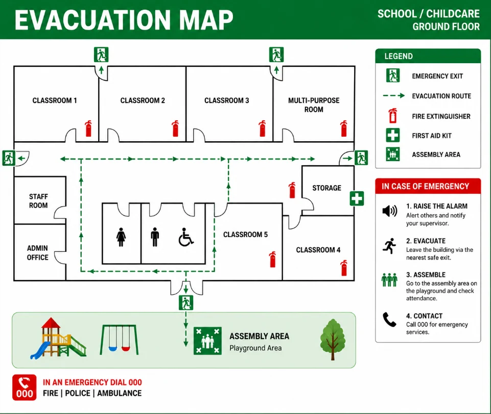
School / Childcare Map

We also create evacuation maps that identify classrooms, hallways, exits, playground assembly areas, and fire safety equipment for schools and childcare facilities.

This map shows locations of:

  • Classrooms and common spaces, aiding staff and children in finding exits quickly.
  • Paths that assist safe evacuation throughout the facility.
  • Areas designated for outdoor gatherings on the playground.
  • Safety equipment such as fire extinguishers and first aid kits.

We design our maps to be simple, yet visually clear and understandable for staff, children and visitors. They are WHS compliant and help support the AS 3745-2010 standard.